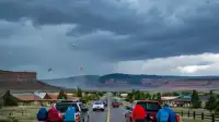
Grand Junction and parts of Southwest Colorado face the risk of flash flooding with heavy rain possible through Thursday. The National Weather Service has issued a Flood Watch for a wide area of Southwest Colorado, effective from Wednesday afternoon until Thursday evening, urging residents to be weather aware.
Grand Junction is expected to see scattered showers and thunderstorms this evening, with temperatures cooling from the low to mid-70s around 7 PM to the mid-60s to low-70s by 9 PM. Wednesday morning will likely start mostly dry in Grand Junction, with a low around 58 degrees, before scattered showers and thunderstorms develop around midday and into the early afternoon. Afternoon highs in Grand Junction are forecast to reach approximately 78 degrees on Wednesday.
The city could experience a break in precipitation Wednesday evening before a more widespread wave of showers and thunderstorms moves through Wednesday night and into Thursday morning. A few scattered showers and thunderstorms remain possible Thursday afternoon, though most of the rain is expected to conclude by then. Friday may also see a few showers and thunderstorms, but activity is anticipated to be less intense than earlier in the week, with the weekend turning drier.
The Flood Watch issued by the National Weather Service encompasses a significant portion of Southwest Colorado. This includes communities such as Telluride, Mountain Village, Ouray, Lake City, Sawpit, Pagosa Springs, Silverton, Rico, Cortez, Mancos, Dolores, Dove Creek, Durango, Bayfield, and Ignacio. Multiple rounds of heavy rain are possible within storms on Wednesday and Thursday, which can lead directly to flash flooding. Areas with the highest risk are those located near creeks, streams, rivers, canyons, and burn scars. Residents in these locations are advised to have a way to receive weather alerts and exercise caution if spending time outdoors.
Forecasters expect additional rainfall totals through Thursday to range from 0.50 to 1.00 inches for valley areas, while higher elevations could see 1.00 to 2.00 inches, with locally higher amounts possible. High temperatures across the region are expected to remain fairly consistent through the end of the week, generally in the mid-70s to low-80s, with more days in the 70s. These projected highs are about five degrees below normal for this time of year. Morning lows for the remainder of the week are forecast to be in the 40s and 50s.