Grand Junction and the wider Mesa County region are preparing for a multi-day stretch of showers and thunderstorms, with the pattern beginning Saturday and forecast to continue through Wednesday, according to KKCO. This incoming weather system is set to bring significantly cooler temperatures to the valley, with daily highs expected to be several degrees below the seasonal average for this time of year.
Tonight, partly cloudy skies are anticipated to give way to clearing mountain showers. However, the conditions will shift as Saturday approaches.
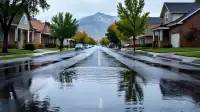
On Saturday, increasing clouds are expected to precede scattered storms, which will grow in coverage by the evening and persist overnight. KKCO clarifies that while storms will be present, the scattered nature means not every area will experience them, and any individual storm is unlikely to last longer than two to three hours over a single region. Wind gusts on Saturday are expected to average between 20 and 30 miles per hour. High temperatures are forecast to range from the low to high 70s, while overnight to morning low temperatures will be in the mid 40s to mid 50s. KKCO also advises residents of a marginal risk for flooding with these showers, urging, “if you don’t know how deep the water is turn around and don’t drown.”
Sunday will see more widespread storms throughout the majority of the day. KKCO notes that 'widespread storms' means there will be periods without rain, rather than a continuous downpour throughout the entire day. Wind gusts on Sunday are expected to be stronger, averaging between 20 and 40 miles per hour. High temperatures will drop further, ranging from the high 60s to low 70s. Overnight to morning low temperatures will remain consistent with Saturday, in the mid 40s to mid 50s. Similar to Saturday, KKCO indicates a marginal to slight risk for flooding, reiterating the critical safety message: 'if you don’t know how deep the water is turn around and don’t drown.'
Looking ahead to the start of the new week, Monday is projected to be a drier day for the Grand Valley, with only isolated showers and thunderstorms. However, scattered showers are expected to return on Tuesday. The storm pattern will then seemingly wrap up on Wednesday, bringing an end to the extended period of unsettled weather. Throughout this forecast period, temperatures across the region will be several degrees cooler than the normal high temperatures typically experienced at this time of year.