
Grand Junction and Mesa County residents can anticipate a period of dry and unseasonably warm weather through the rest of this week, before the potential return of showers and thunderstorms over the upcoming weekend, according to local weather observers. While forecasters note that many factors can shift between now and then, current data points toward a possible change in conditions by Saturday and Sunday.
Wednesday is forecast to be a sunny day, marked by only a few passing clouds in the sky. Temperatures are predicted to experience a significant climb over the course of the day. Starting from the cooler range of mid-to-upper 50s and lower 60s around 7 AM, the Grand Valley can expect temperatures to rise into the upper 70s and lower 80s by midday. As the afternoon progresses towards 4 PM, the mercury is projected to reach the mid-to-upper 80s across the area.
Specifically for afternoon high temperatures, the Grand Junction vicinity is expected to see readings near 90 degrees. Nearby communities will also experience similar warm conditions. Montrose is projected to reach 88 degrees, while both Delta and Cortez are forecast to hit approximately 91 degrees. Further to the west, Moab's high temperature is predicted to be around 92 degrees. Looking at the morning's cooler temperatures, Grand Junction's low will be near 60 degrees, Montrose at 56 degrees, Delta at 58 degrees, Cortez at 53 degrees, and Moab near 59 degrees.
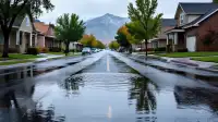
Shifting focus to the weekend, there is a possibility of more rain making its way back into the region. Present forecast data indicates an atmospheric environment that will on-and-off favor scattered showers and thunderstorms across both Saturday and Sunday. Analysis suggests that the mornings and evenings of these days appear to be the most favored periods for precipitation. However, for the majority of Saturday and Sunday, the bulk of the daylight hours may well remain dry.
It is important to note that, as is frequently the case with scattered weather systems, any rainfall that does occur will be unevenly distributed across the landscape. This means that while certain locales within the Grand Valley and its surrounding areas could receive substantial amounts of rain, other nearby areas might remain completely dry. Forecasters highlight that in places where rain does fall, it could be heavy enough to potentially lead to localized flash flooding. Residents are encouraged to monitor updated local forecasts, as weather patterns can evolve quickly.